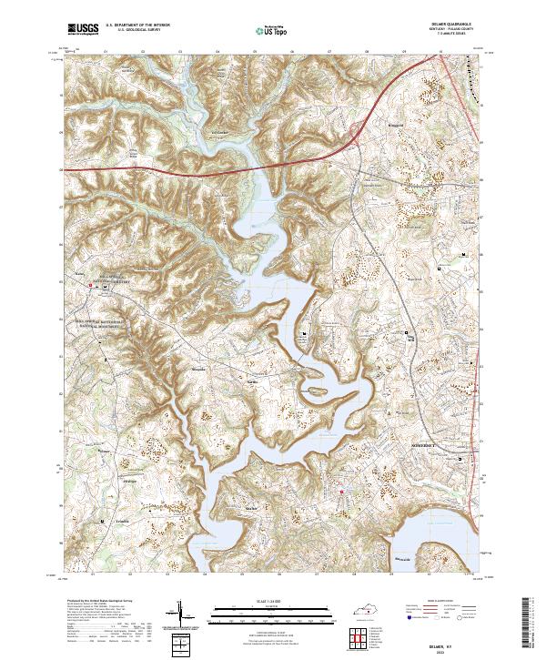
2022 Map of Delmer
USGS Topo · Published 2022About this map
Mill Springs Battlefield National Monument preserves a critical Civil War landscape near Nancy, where the dendritic fingers of Lake Cumberland now reach into the steep valleys of Pulaski County. The terrain is defined by prominent ridges like Hickory Nut Ridge and Piney Grove Ridge, separated by deep hollows such as Hamby Hollow and Todd Hollow. Local history is anchored by numerous small communities and cemeteries, including the Mill Springs National Cemetery and Zollicoffer Park Cemetery, which mark the significance of this area's heritage. The map also documents the modern interface of recreation and infrastructure, from Lee's Airpark to the winding corridors of KY 80 and Us 27 that connect the smaller settlements of Oil Center, Shepola, and Sardis to the regional hub at Somerset.
Find a feature on this map
57 named features on this map. Tap any name to fly to it.
Don’t see what you’re looking for? This feature index may not catch every label — zoom into the map to look around manually.
Map Details
Editions of this 2022 Delmer Map
This is the sole edition of this map. No revisions or reprints were ever made.
Other maps of this area

1911 · Monticello
USGS Topo · 1:62,500

1914 · Monticello
USGS Topo · 1:62,500

1932 · Burnside
USGS Topo · 1:62,500

1935 · Somerset
USGS Topo · 1:62,500

1953 · Frazer
USGS Topo · 1:24,000

1953 · Mintonville
USGS Topo · 1:24,000

1953 · Mill Springs
USGS Topo · 1:24,000
1954 · Bobtown
USGS Topo · 1:24,000

1954 · Burnside
USGS Topo · 1:24,000

1954 · Delmer
USGS Topo · 1:24,000