
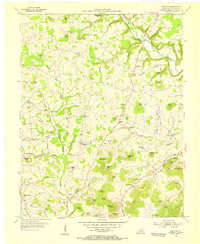
1954 Map of Delmer
USGS Topo · Published 1955About this map
Lake Cumberland and Fishing Creek Lake dominate the landscape of Pulaski County in this mid-century survey, illustrating a region transformed by controlled inundation. The waters of the Cumberland River fill deep valleys, creating a complex shoreline that wraps around prominent terrain features like Potato Knoll and Denham Knob. This new geography coexists with deep-rooted settlements such as Oil Center, Nancy, and Delmer, while recreation and infrastructure adapt to the rising water level through landmarks like Lees Ford Dock and the Fishing Creek Bridge.
Find a feature on this map
81 named features on this map. Tap any name to fly to it.
Don’t see what you’re looking for? This feature index may not catch every label — zoom into the map to look around manually.
Map Details
Editions of this 1954 Delmer Map
This is the sole edition of this map. No revisions or reprints were ever made.
Other maps of this area

1911 · Monticello
USGS Topo · 1:62,500

1914 · Monticello
USGS Topo · 1:62,500

1932 · Burnside
USGS Topo · 1:62,500

1935 · Somerset
USGS Topo · 1:62,500

1953 · Frazer
USGS Topo · 1:24,000

1953 · Mintonville
USGS Topo · 1:24,000

1953 · Mill Springs
USGS Topo · 1:24,000
1954 · Bobtown
USGS Topo · 1:24,000

1954 · Burnside
USGS Topo · 1:24,000

1954 · Science Hill
USGS Topo · 1:24,000