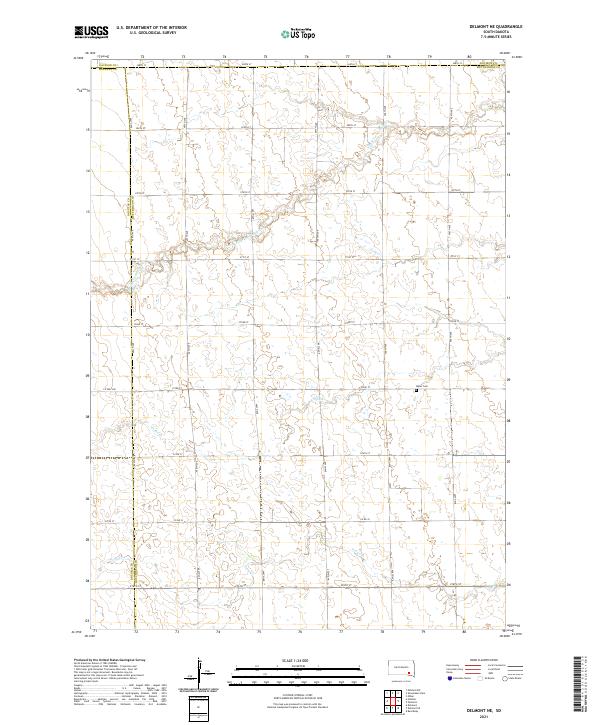
2021 Map of Delmont NE
USGS Topo · Published 2021About this map
Miller Cem sits at the heart of this rural landscape in eastern Hutchinson County, where the agricultural grid is defined by a dense network of section line roads like 407th Ave and 273rd St. The terrain is carved by meandering waterways, including S Fork Twelvemile Cr in the north and the winding paths of Coffee Creek and Pony Creek further south. This 2021 survey illustrates the modern continuity of the Public Land Survey System, showing how the boundaries of Douglas, Davison, and Hutchinson counties meet amidst a landscape of small seasonal wetlands and drainage basins. The map provides an essential record for local historians studying the rural township structure and the enduring family landmarks of the South Dakota plains.
Find a feature on this map
31 named features on this map. Tap any name to fly to it.
Don’t see what you’re looking for? This feature index may not catch every label — zoom into the map to look around manually.
Map Details
Editions of this 2021 Delmont NE Map
This is the sole edition of this map. No revisions or reprints were ever made.
Other maps of this area

1898 · Olivet
USGS Topo · 1:125,000

1899 · Mitchell
USGS Topo · 1:125,000

1899 · Alexandria
USGS Topo · 1:125,000

1955 · Sioux Falls
USGS Topo · 1:250,000

1955 · Mitchell
USGS Topo · 1:250,000

1957 · Ethan
USGS Topo · 1:24,000

1958 · Sioux Falls
USGS Topo · 1:250,000

1959 · Mitchell
USGS Topo · 1:250,000

1979 · Delmont
USGS Topo · 1:24,000
1979 · Delmont NE
USGS Topo · 1:24,000