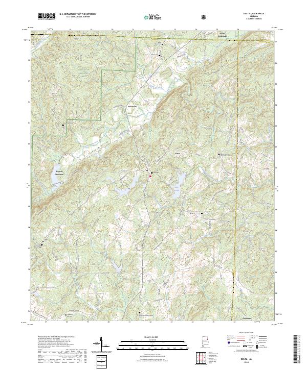
2024 Map of Delta
USGS Topo · Published 2024About this map
Fishhead Valley and the prominent Shinbone Ridge define the rugged topography of this Clay County landscape, where the Talladega National Forest covers much of the northwestern terrain. The settlement of Delta serves as a central point, surrounded by a network of smaller communities like Needmore, Hollis Crossroads, and Haynes Crossroad. This area is characterized by a high density of rural religious and funerary sites, including the Shiloh Primitive Baptist Church Cem and Blacks Chapel Methodist Church Cem, which are vital for genealogical research in this part of Alabama. The drainage systems of Ketchepedrakee Creek and Chulafinnee Creek carve through the ridges, while Lake Gerald provides a localized water feature amidst the timbered hills. The map captures the meeting point of Clay, Cleburne, and Randolph counties, illustrating a modern road network that follows long-established valley corridors.
Find a feature on this map
107 named features on this map. Tap any name to fly to it.
Don’t see what you’re looking for? This feature index may not catch every label — zoom into the map to look around manually.
Map Details
Editions of this 2024 Delta Map
This is the sole edition of this map. No revisions or reprints were ever made.
Other maps of this area

1891 · Ashland
USGS Topo · 1:125,000

1900 · Anniston
USGS Topo · 1:125,000

1947 · Oxford
USGS Topo · 1:24,000

1950 · Anniston
USGS Topo · 1:62,500

1953 · Atlanta
USGS Topo · 1:250,000

1956 · Oxford
USGS Topo · 1:24,000

1957 · Atlanta
USGS Topo · 1:250,000

1958 · Atlanta
USGS Topo · 1:250,000
1967 · Ross Mountain
USGS Topo · 1:24,000
1967 · Hollis Crossroads
USGS Topo · 1:24,000