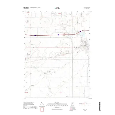
2019 Map of Delta
USGS Topo · Published 2019About this map
Delta and West Delta serve as the primary population centers in this rural Fulton County landscape, where the geometry of county roads like Co RD HJ and Co RD H intersects with the natural meandering of Bad Cr. The area is notably dense with small, historically significant burial grounds, providing a valuable record for genealogical research through sites such as Old Delta Cem, Greenlawn Cem, and Berkebile Cem. A distinct recreational and transit corridor is formed by the N Country National Scenic Trail, which traverses the township lines south of the main settlements. To the northwest, the Fulton County Airport and the small community of Winameg represent the continued utility of the land, while the southern reaches are defined by the headwaters of N Turkeyfoot Cr and Dry Cr.
Find a feature on this map
45 named features on this map. Tap any name to fly to it.
Don’t see what you’re looking for? This feature index may not catch every label — zoom into the map to look around manually.
Map Details
Editions of this 2019 Delta Map
This is the sole edition of this map. No revisions or reprints were ever made.
Other maps of this area

1908 · Napoleon
USGS Topo · 1:62,500

1909 · Mc Clure
USGS Topo · 1:62,500

1911 · Wauseon
USGS Topo · 1:62,500

1911 · Swanton
USGS Topo · 1:62,500

1913 · Wauseon
USGS Topo · 1:62,500

1914 · Swanton
USGS Topo · 1:62,500

1943 · Wauseon
USGS Topo · 1:62,500

1953 · Fort Wayne
USGS Topo · 1:250,000

1956 · Fort Wayne
USGS Topo · 1:250,000

1956 · Toledo
USGS Topo · 1:250,000