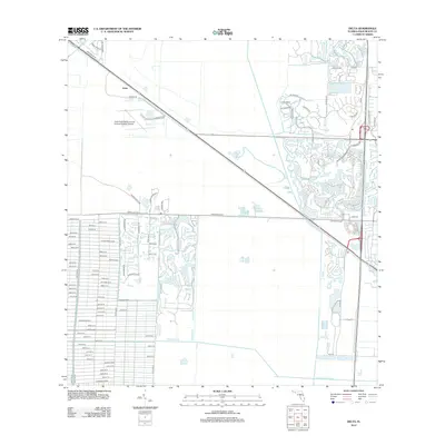
2012 Map of Delta
USGS Topo · Published 2012About this map
North Palm Beach County General Aviation Airport anchors this landscape, serving as a focal point for the developing community of Delta. The terrain is defined by the significant wetland expanse of the Loxahatchee Slough, which borders modern residential subdivisions and a dense grid of residential streets. South of Northlake Blvd, the map reveals a meticulously planned network of roads with names reflecting the area's agricultural heritage, such as Citrus Grove Blvd and Key Lime Blvd. The presence of the Loxahatchee Canal at the southern edge highlights the critical role of water management in this portion of the Florida Everglades fringe, where the transition from natural sloughs to suburban residential blocks is clearly demarcated.
Find a feature on this map
86 named features on this map. Tap any name to fly to it.
Don’t see what you’re looking for? This feature index may not catch every label — zoom into the map to look around manually.
Map Details
Editions of this 2012 Delta Map
This is the sole edition of this map. No revisions or reprints were ever made.
Other maps of this area

1945 · Delta
USGS Topo · 1:24,000

1946 · Riviera Beach
USGS Topo · 1:24,000

1946 · Palm Beach Farms
USGS Topo · 1:24,000

1946 · Palm Beach
USGS Topo · 1:24,000

1948 · Rood
USGS Topo · 1:24,000

1948 · Jupiter
USGS Topo · 1:24,000

1949 · Rood
USGS Topo · 1:24,000

1949 · Palm Beach Farms
USGS Topo · 1:24,000

1949 · Riviera Beach
USGS Topo · 1:24,000

1950 · Jupiter
USGS Topo · 1:24,000