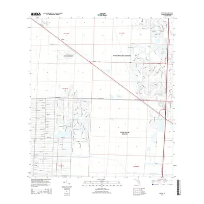
2015 Map of Delta
USGS Topo · Published 2015About this map
Loxahatchee Slough dominates the central portion of this 2015 study, representing a significant natural landscape buffered by the expanding residential footprints of Palm Beach Gardens and West Palm Beach. The geography is defined by a rigid grid of major thoroughfares like PGA Blvd and Northlake Blvd, which intersect with Florida's Tpke to facilitate movement through the coastal plain.
Find a feature on this map
20 named features on this map. Tap any name to fly to it.
Don’t see what you’re looking for? This feature index may not catch every label — zoom into the map to look around manually.
Map Details
Editions of this 2015 Delta Map
This is the sole edition of this map. No revisions or reprints were ever made.
Other maps of this area

1945 · Delta
USGS Topo · 1:24,000

1946 · Riviera Beach
USGS Topo · 1:24,000

1946 · Palm Beach Farms
USGS Topo · 1:24,000

1946 · Palm Beach
USGS Topo · 1:24,000

1948 · Rood
USGS Topo · 1:24,000

1948 · Jupiter
USGS Topo · 1:24,000

1949 · Rood
USGS Topo · 1:24,000

1949 · Palm Beach Farms
USGS Topo · 1:24,000

1949 · Riviera Beach
USGS Topo · 1:24,000

1950 · Jupiter
USGS Topo · 1:24,000