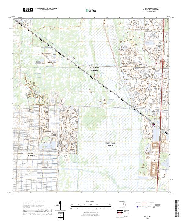
2024 Map of Delta
USGS Topo · Published 2024About this map
Palm Beach Gardens and West Palm Beach meet the intricate hydrology of the northern Everglades in this recent topographic study. The landscape is defined by the contrast between organized residential developments and the protected wetlands of the Loxahatchee Slough. Major infrastructure, including PGA Blvd and the North Palm Beach County General Aviation airport, serves the growing community of Delta. Water management is central to the area's layout, with the M Canal and Loxahatchee Canal providing essential drainage for the western residential pockets of The Acreage. Recreational and environmental conservation are represented by the Loxahatchee Slough Natural Area Trl, which winds through the wetland system that still dominates much of the central quadrangle.
Find a feature on this map
160 named features on this map. Tap any name to fly to it.
Don’t see what you’re looking for? This feature index may not catch every label — zoom into the map to look around manually.
Map Details
Editions of this 2024 Delta Map
This is the sole edition of this map. No revisions or reprints were ever made.
Other maps of this area

1945 · Delta
USGS Topo · 1:24,000

1946 · Riviera Beach
USGS Topo · 1:24,000

1946 · Palm Beach Farms
USGS Topo · 1:24,000

1946 · Palm Beach
USGS Topo · 1:24,000

1948 · Rood
USGS Topo · 1:24,000

1948 · Jupiter
USGS Topo · 1:24,000

1949 · Rood
USGS Topo · 1:24,000

1949 · Palm Beach Farms
USGS Topo · 1:24,000

1949 · Riviera Beach
USGS Topo · 1:24,000

1950 · Jupiter
USGS Topo · 1:24,000