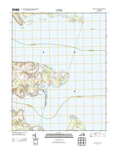
2013 Map of Deltaville
USGS Topo · Published 2013About this map
Deltaville sits at the narrow tip of the Middle Peninsula, where the Rappahannock River and Piankatank River converge before entering the Chesapeake Bay. This 2013 landscape is defined by its deep maritime heritage, evident in the cluster of nautical facilities like the Stingray Point Marina and Deltaville-Marina. The shoreline is heavily articulated with points and necks, including the prominent Stove Point Neck and the easternmost tip at Stingray Point.
Find a feature on this map
87 named features on this map. Tap any name to fly to it.
Don’t see what you’re looking for? This feature index may not catch every label — zoom into the map to look around manually.
Map Details
Editions of this 2013 Deltaville Map
This is the sole edition of this map. No revisions or reprints were ever made.
Other maps of this area

1916 · Kilmarnock
USGS Topo · 1:48,000

1916 · Mathews
USGS Topo · 1:62,500

1917 · Kilmarnock
USGS Topo · 1:62,500

1917 · Mathews
USGS Topo · 1:62,500

1942 · Kilmarnock
USGS Topo · 1:62,500

1943 · Richmond
USGS Topo · 1:250,000

1948 · Ware Neck
USGS Topo · 1:24,000

1948 · Deltaville
USGS Topo · 1:24,000

1948 · Mathews
USGS Topo · 1:24,000
1949 · Irvington
USGS Topo · 1:24,000