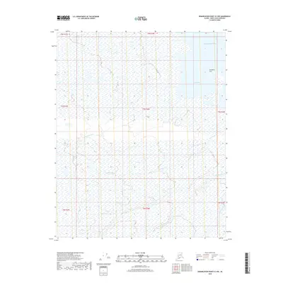
2018 Map of Demarcation Point D-3 NW
USGS Topo · Published 2018About this map
Humphrey Point stands as a prominent coastal landmark on this northern shoreline, marking the boundary between the vast Arctic tundra and the Beaufort Sea. This 2018 survey reveals a landscape dominated by complex drainage systems and seasonal wetlands, where the Pokok Bay provides a protected inlet for the Arctic waters. The map meticulously traces the winding paths of several coastal waterways, including the Kikiktpaurauk River and the Siksik River, which meander through the low-lying terrain. Further south, the braided channels of the Sikrelurak River and Angun River illustrate the dynamic hydrological patterns of the North Slope. This topographic study captures a remote environment where land and water merge through an intricate network of lakes and river deltas, essential for understanding the shifting coastal geography of the Alaska Arctic.
Find a feature on this map
15 named features on this map. Tap any name to fly to it.
Don’t see what you’re looking for? This feature index may not catch every label — zoom into the map to look around manually.
Map Details
Editions of this 2018 Demarcation Point D-3 NW Map
This is the sole edition of this map. No revisions or reprints were ever made.
Other maps of this area

1951 · Barter Island
USGS Topo · 1:250,000

1951 · Demarcation Point
USGS Topo · 1:250,000

1955 · Demarcation Point
USGS Topo · 1:250,000

1955 · Demarcation Point D-3
USGS Topo · 1:63,360

1955 · Barter Island A-4
USGS Topo · 1:63,360
1955 · Barter Island A-3
USGS Topo · 1:63,360

1955 · Demarcation Point D-4
USGS Topo · 1:63,360

1959 · Barter Island
USGS Topo · 1:250,000

1962 · Demarcation Point D-3
USGS Topo · 1:50,000

1964 · Demarcation Point
USGS Topo · 1:250,000