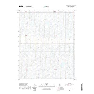
2018 Map of Demarcation Point D-4 NE
USGS Topo · Published 2018About this map
Niguanak River serves as the central geographic feature on this Arctic landscape, winding through the tundra of the North Slope Borough. This topographic study documents a transition zone where water and wetlands dominate the terrain, reflecting the environmental conditions of the region in the early twenty-first century. The map is organized by the Public Land Survey System, illustrating township and range divisions including t8n r36e, t7n r36e, and t6n r37e. While the area is devoid of permanent settlements or roads, the detailed contouring reveals the subtle elevation changes of the river basin and surrounding plains. For those studying the hydrology or land use of northern Alaska, this map provides a clear record of the river's path and the extensive wetland networks that define this part of the Demarcation Point quadrangle.
Find a feature on this map
7 named features on this map. Tap any name to fly to it.
Don’t see what you’re looking for? This feature index may not catch every label — zoom into the map to look around manually.
Map Details
Editions of this 2018 Demarcation Point D-4 NE Map
This is the sole edition of this map. No revisions or reprints were ever made.
Other maps of this area

1951 · Barter Island
USGS Topo · 1:250,000

1951 · Demarcation Point
USGS Topo · 1:250,000

1955 · Demarcation Point
USGS Topo · 1:250,000

1955 · Demarcation Point D-3
USGS Topo · 1:63,360

1955 · Barter Island A-4
USGS Topo · 1:63,360
1955 · Barter Island A-3
USGS Topo · 1:63,360

1955 · Demarcation Point D-4
USGS Topo · 1:63,360

1959 · Barter Island
USGS Topo · 1:250,000

1962 · Demarcation Point D-3
USGS Topo · 1:50,000

1964 · Demarcation Point
USGS Topo · 1:250,000