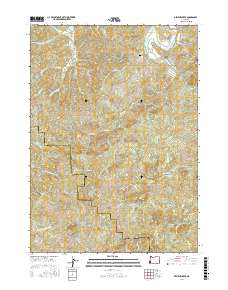
2017 Map of Dement Creek
USGS Topo · Published 2017About this map
The South Fork Coquille River carves through the northeastern corner of this coastal Oregon landscape, marking a vital corridor for the historical Railroad Grade that follows its banks. The terrain is defined by a dense network of drainages, including Dement Creek, Catching Creek, and the headwaters of the North Fork Sikes River, illustrating the complex hydrology of the Coos and Curry County line. Genealogists and local historians will find the Dement Cemetery situated near the intersection of Dement Creek Road and Hermann Drive, serving as a quiet landmark of early regional settlement. Ridge-top navigation is traced through routes like Eckley Mountain Road, which connects high points like Whoorey Mountain to the creek valleys below.
Find a feature on this map
36 named features on this map. Tap any name to fly to it.
Don’t see what you’re looking for? This feature index may not catch every label — zoom into the map to look around manually.
Map Details
Editions of this 2017 Dement Creek Map
This is the sole edition of this map. No revisions or reprints were ever made.
Other maps of this area

1896 · Coos Bay
USGS Topo · 1:125,000

1898 · Coos Bay
USGS Topo · 1:125,000

1899 · Port Orford
USGS Topo · 1:125,000

1900 · Coos Bay
USGS Topo · 1:125,000

1903 · Port Orford
USGS Topo · 1:125,000

1942 · Coquille
USGS Topo · 1:62,500

1943 · Bandon
USGS Topo · 1:62,500

1944 · Bandon
USGS Topo · 1:62,500

1945 · Coquille
USGS Topo · 1:62,500

1954 · Coos Bay
USGS Topo · 1:250,000