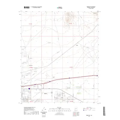
2023 Map of Deming East
USGS Topo · Published 2023About this map
The city of Deming anchors the southwestern quadrant of this 2023 survey, revealing the modern infrastructure and residential expansion of this Luna County hub. The street grid is meticulously detailed, showing developments such as Pecan Park and Ventura alongside established sites like the Mountain View Cem and the Deming Municipal Airport. The landscape beyond the city limits is defined by arid drainage patterns, including China Draw and Starvation Draw, which trend toward the seasonal Mimbres River as it winds through the desert floor. To the northeast, the terrain rises toward the foothills of the Cookes Range, providing a sharp contrast to the flat valley floor. Smaller settlements and agricultural outposts like Keeler Farm and Mirage punctuate the landscape, illustrating the persistent reach of rural habitation in this high-desert environment.
Find a feature on this map
85 named features on this map. Tap any name to fly to it.
Don’t see what you’re looking for? This feature index may not catch every label — zoom into the map to look around manually.
Map Details
Editions of this 2023 Deming East Map
This is the sole edition of this map. No revisions or reprints were ever made.
Other maps of this area

1899 · Deming
USGS Topo · 1:125,000

1915 · Deming
USGS Topo · 1:125,000

1955 · Las Cruces
USGS Topo · 1:250,000

1958 · Las Cruces
USGS Topo · 1:250,000

1964 · Goat Ridge
USGS Topo · 1:24,000

1964 · Florida
USGS Topo · 1:24,000

1964 · Deming West
USGS Topo · 1:24,000

1964 · Massacre Peak
USGS Topo · 1:24,000

1964 · Florida Gap
USGS Topo · 1:24,000

1965 · Deming East
USGS Topo · 1:24,000