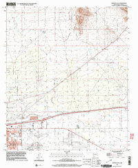
1996 Map of Deming East
USGS Topo · Published 2003About this map
The high desert city of Deming serves as the focal point of this 1990s survey, illustrating a community defined by its water sources and transportation corridors. The Mimbres River and several drainage features, including China Draw and Starvation Draw, cross the landscape, while numerous windmills like Spider Windmill and Sagebrush Windmill suggest the reliance on groundwater in this arid environment. The town's social and recreational infrastructure is well-documented, featuring the Rio Mimbres Country Club, the Lloyd Pratz Athletic Complex, and Mountain View Cemetery.
Find a feature on this map
25 named features on this map. Tap any name to fly to it.
Don’t see what you’re looking for? This feature index may not catch every label — zoom into the map to look around manually.
Map Details
Editions of this 1996 Deming East Map
This is the sole edition of this map. No revisions or reprints were ever made.
Other maps of this area

1899 · Deming
USGS Topo · 1:125,000

1915 · Deming
USGS Topo · 1:125,000

1955 · Las Cruces
USGS Topo · 1:250,000

1958 · Las Cruces
USGS Topo · 1:250,000

1964 · Goat Ridge
USGS Topo · 1:24,000

1964 · Florida
USGS Topo · 1:24,000

1964 · Deming West
USGS Topo · 1:24,000

1964 · Massacre Peak
USGS Topo · 1:24,000

1964 · Florida Gap
USGS Topo · 1:24,000

1965 · Deming East
USGS Topo · 1:24,000