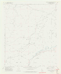
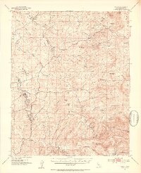
1972 Map of Democrat Hot Springs
USGS Topo · Published 1975About this map
The Kern River carves through this portion of the Greenhorn Mountains, revealing a landscape defined by hydraulic infrastructure and geothermal activity in the early 1970s. At Democrat Hot Springs, the map details a cluster of development including mines, a flume, and multiple gaging stations, illustrating the industrial management of the river's flow. Higher in the terrain, the Kern River No 1 Flow Line snakes across the slopes above Democrat Spring.
Find a feature on this map
58 named features on this map. Tap any name to fly to it.
Don’t see what you’re looking for? This feature index may not catch every label — zoom into the map to look around manually.
Map Details
Editions of this 1972 Democrat Hot Springs Map
4 editions found
Other maps of this area

1914 · Caliente
USGS Topo · 1:125,000

1920 · Delonagha
USGS Topo · 1:62,500

1926 · Glennville
USGS Topo · 1:62,500

1932 · Woody
USGS Topo · 1:62,500

1935 · Woody
USGS Topo · 1:62,500

1936 · Tobias Peak
USGS Topo · 1:125,000

1943 · Breckenridge Mountain
USGS Topo · 1:62,500

1943 · Tobias Peak
USGS Topo · 1:125,000

1948 · Bakersfield
USGS Topo · 1:250,000
1952 · Woody
USGS Topo · 1:62,500