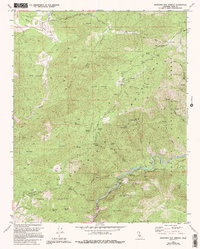
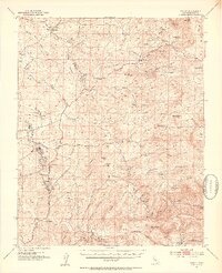
1972 Map of Democrat Hot Springs
USGS Topo · Published 1994About this map
Democrat Hot Springs sits along a sharp southern bend of the Kern River, serving as a focal point for this section of the Sequoia National Forest during the early 1970s. The landscape is defined by its deep canyons and significant vertical relief, with peaks like Ball Mountain and Saturday Peak overlooking a complex network of drainages including Poso Creek and Rancheria Creek. Infrastructure of the era is represented by the Oak Flat Lookout and a Gaging Station situated on the river, while human presence is concentrated at the French Ranch and along established routes such as Coffee Grade Road.
Find a feature on this map
35 named features on this map. Tap any name to fly to it.
Don’t see what you’re looking for? This feature index may not catch every label — zoom into the map to look around manually.
Map Details
Editions of this 1972 Democrat Hot Springs Map
4 editions found
Other maps of this area

1914 · Caliente
USGS Topo · 1:125,000

1920 · Delonagha
USGS Topo · 1:62,500

1926 · Glennville
USGS Topo · 1:62,500

1932 · Woody
USGS Topo · 1:62,500

1935 · Woody
USGS Topo · 1:62,500

1936 · Tobias Peak
USGS Topo · 1:125,000

1943 · Breckenridge Mountain
USGS Topo · 1:62,500

1943 · Tobias Peak
USGS Topo · 1:125,000

1948 · Bakersfield
USGS Topo · 1:250,000
1952 · Woody
USGS Topo · 1:62,500