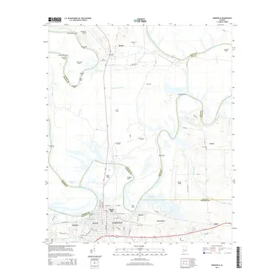
2014 Map of Demopolis
USGS Topo · Published 2014About this map
Demopolis serves as the focal point of this Marengo County landscape, situated where the Black Warrior River and Tombigbee River converge. The town's grid expands from the riverfront, reaching toward neighborhoods like Baptist Hill and Rockcut. The surrounding territory is defined by the winding hydrology of the rivers, marked by specific navigation points such as Webbs Bend and Twelvemile Bend, and numerous river bars including Negro Heel Bar and Haunted Point Bar.
Find a feature on this map
92 named features on this map. Tap any name to fly to it.
Don’t see what you’re looking for? This feature index may not catch every label — zoom into the map to look around manually.
Map Details
Editions of this 2014 Demopolis Map
This is the sole edition of this map. No revisions or reprints were ever made.
Other maps of this area

1946 · Demopolis
USGS Topo · 1:24,000

1947 · Demopolis
USGS Topo · 1:24,000

1947 · Mason Bend
USGS Topo · 1:24,000

1947 · Forkland
USGS Topo · 1:24,000

1948 · Mason Bend
USGS Topo · 1:24,000

1948 · Mc Dowell
USGS Topo · 1:24,000

1949 · Mc Dowell
USGS Topo · 1:24,000

1949 · Forkland
USGS Topo · 1:24,000

1953 · Montgomery
USGS Topo · 1:250,000

1956 · Montgomery
USGS Topo · 1:250,000