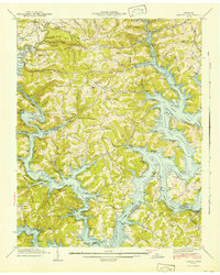
1941 Map of Demory
USGS Topo · Published 1941About this map
Norris Reservoir dominates this 1941 landscape, its rising waters filling the deep valleys formed by the Powell River, Clinch River, and Cedar Creek. The map documents a critical transition for the Tennessee Valley, showing the newly formed shoreline alongside established upland settlements like Demory and Grantsboro. This survey is particularly valuable for genealogists, as it captures the locations of numerous family and community burial grounds, including the Baker Forge Memorial Cem, Hicks Cem, and Pond Cem, many of which were situated near the reservoir's edge.
Find a feature on this map
52 named features on this map. Tap any name to fly to it.
Don’t see what you’re looking for? This feature index may not catch every label — zoom into the map to look around manually.
Map Details
Editions of this 1941 Demory Map
2 editions found
Other maps of this area

1893 · Briceville
USGS Topo · 1:125,000

1895 · Briceville
USGS Topo · 1:125,000

1896 · Briceville
USGS Topo · 1:125,000

1897 · Maynardville
USGS Topo · 1:125,000

1900 · Maynardville
USGS Topo · 1:125,000

1935 · Well Spring
USGS Topo · 1:24,000

1936 · Gorryton
USGS Topo · 1:48,000

1936 · Ivydell
USGS Topo · 1:24,000

1936 · Jacksboro
USGS Topo · 1:24,000

1936 · White Hollow
USGS Topo · 1:24,000