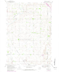
1969 Map of Dempster
USGS Topo · Published 1982About this map
The Dempster townsite sits at the intersection of prairie agriculture and the Chicago and North Western railroad line in this late 1960s landscape. This portion of the Glacial Lake Agassiz region shows a highly managed water system, dominated by the Big Sioux River and the engineered Boswell Diversion Ditch, which redirect flow across the plains of Hamlin County. The terrain is further defined by Stray Horse Creek and Hide Wood Creek, weaving through a grid of townships like Havana and Estelline. Cultural landmarks include the Bemis Ch and its adjacent Cem, along with the Hamlin Ch, serving as the social anchors for the surrounding farmsteads. Industrial activity is represented by several Gravel Pits, indicating the local extraction of glacial deposits that characterize this eastern South Dakota geography.
Find a feature on this map
18 named features on this map. Tap any name to fly to it.
Don’t see what you’re looking for? This feature index may not catch every label — zoom into the map to look around manually.
Map Details
Editions of this 1969 Dempster Map
2 editions found
Other maps of this area

1953 · Watertown
USGS Topo · 1:250,000

1958 · Watertown
USGS Topo · 1:250,000

1969 · Dempster
USGS Topo · 1:24,000

1969 · Castlewood
USGS Topo · 1:24,000

1969 · Watertown SE
USGS Topo · 1:24,000

1969 · Lake Poinsett
USGS Topo · 1:24,000

1970 · Kranzburg SW
USGS Topo · 1:24,000

1970 · Bemis
USGS Topo · 1:24,000

1970 · Estelline SE
USGS Topo · 1:24,000

1970 · Estelline
USGS Topo · 1:24,000