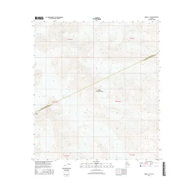
2016 Map of Denali A-1 NE
USGS Topo · Published 2016About this map
Denali National Park encompasses the majority of this high-altitude landscape, where the boundary between the Denali Borough and the Matanuska-Susitna Borough cuts diagonally across the terrain. This is a region dominated by the massive glacial ice and extreme relief of the Alaska Range, seen most prominently in the upper northwest where the W Fork Glacier flows. The map provides a detailed view of the natural topography through closely packed contour lines, illustrating the complex drainage patterns and ridgelines that define this protected wilderness. In this 2016 survey, the land remains largely untouched by development, focusing instead on the intersection of administrative jurisdictions within the heart of the national park system.
Find a feature on this map
10 named features on this map. Tap any name to fly to it.
Don’t see what you’re looking for? This feature index may not catch every label — zoom into the map to look around manually.
Map Details
Editions of this 2016 Denali A-1 NE Map
This is the sole edition of this map. No revisions or reprints were ever made.
Other maps of this area

1949 · Healy A-6
USGS Topo · 1:63,360

1951 · Healy
USGS Topo · 1:250,000

1952 · Mount McKinley
USGS Topo · 1:250,000

1952 · Mount McKinley B-1
USGS Topo · 1:63,360

1953 · Healy A-6
USGS Topo · 1:63,360

1954 · Healy B-6
USGS Topo · 1:63,360

1954 · Mount McKinley B-1
USGS Topo · 1:63,360

1954 · Mount McKinley A-1
USGS Topo · 1:63,360

1956 · Healy
USGS Topo · 1:250,000

1958 · Mount McKinley
USGS Topo · 1:250,000