
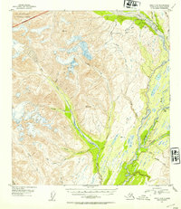
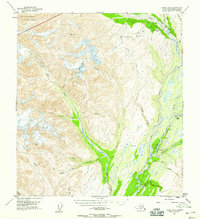
1953 Map of Healy A-6
USGS Topo · Published 1954About this map
Mining operations and the essential steel ribbon of the Alaska Railroad define this remote stretch of the Alaska Range during the mid-century. High-altitude resource extraction is evident at the Golden Zone Mine and Silver King Mine in the northern reaches, supported by infrastructure like the Blind Ditch. The landscape is dominated by the massive Eldridge Glacier and the headwaters of the West Fork Chulitna River, which flows past landmarks like Hurricane Gulch. The northwestern corner preserves a portion of Mt Mc Kinley National Park, illustrating the early boundary of this protected wilderness. This 1953 survey captures a moment when the regional economy relied heavily on the transit corridor following the river forks, connecting isolated mountain peaks like Lookout Mtn to the wider territory.
Find a feature on this map
33 named features on this map. Tap any name to fly to it.
Don’t see what you’re looking for? This feature index may not catch every label — zoom into the map to look around manually.
Map Details
Editions of this 1953 Healy A-6 Map
3 editions found
Other maps of this area

1949 · Talkeetna Mountains D-6
USGS Topo · 1:63,360

1949 · Healy A-6
USGS Topo · 1:63,360

1950 · Talkeetna Mountains
USGS Topo · 1:250,000

1950 · Talkeetna
USGS Topo · 1:250,000

1950 · Talkeetna Mountains D-5
USGS Topo · 1:63,360

1950 · Healy A-5
USGS Topo · 1:63,360

1950 · Healy B-5
USGS Topo · 1:63,360

1951 · Talkeetna
USGS Topo · 1:250,000

1951 · Healy
USGS Topo · 1:250,000

1951 · Talkeetna Mountains D-5
USGS Topo · 1:63,360