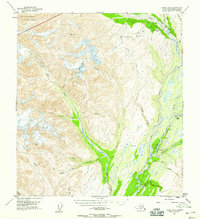
1953 Map of Healy A-6
USGS Topo · Published 1959About this map
The massive Eldridge Glacier flows through the western reaches of this area within the Alaska Range, where high-altitude peaks and deep glacial valleys meet the lower-elevation transport corridors. In the east, The Alaska Railroad parallels The Chulitna River, serving small stops like Honolulu and designated mileposts such as Mile 285. The proximity of the railroad to the river indicates the vital role of this corridor in connecting the interior of Alaska during the mid-20th century.
Find a feature on this map
33 named features on this map. Tap any name to fly to it.
Don’t see what you’re looking for? This feature index may not catch every label — zoom into the map to look around manually.
Map Details
Editions of this 1953 Healy A-6 Map
3 editions found

Other maps of this area

1949 · Talkeetna Mountains D-6
USGS Topo · 1:63,360

1949 · Healy A-6
USGS Topo · 1:63,360

1950 · Talkeetna Mountains
USGS Topo · 1:250,000

1950 · Talkeetna
USGS Topo · 1:250,000

1950 · Talkeetna Mountains D-5
USGS Topo · 1:63,360

1950 · Healy A-5
USGS Topo · 1:63,360

1950 · Healy B-5
USGS Topo · 1:63,360

1951 · Talkeetna
USGS Topo · 1:250,000

1951 · Healy
USGS Topo · 1:250,000

1951 · Talkeetna Mountains D-5
USGS Topo · 1:63,360