
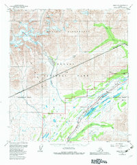
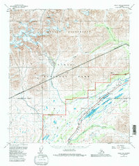
1950 Map of Healy B-5
USGS Topo · Published 1974About this map
Mount McKinley National Park and the high mountain passes of the Alaska Range dominate this mid-century survey, which focuses on the critical transportation corridor through the interior. The Alaska Railroad snakes through the center of the sheet, reaching a high point at the settlement of Summit, where infrastructure including a CAA Station, Water Tank, and a Landing Strip supported transit through this difficult terrain. The landscape is defined by massive glacial features, notably the Cantwell Glacier and the headwaters of the Bull River. South of Foggy Pass, numerous small alpine bodies of water such as Summit Lake, Mirror Lake, and Edes Lake sit near the boundary of the Matanuska-Susitna Borough. The map also details the drainage of the Middle Fork Chulitna River, illustrating the complex network of creeks like Windy Creek and Squaw Creek that feed the region's major river systems.
Find a feature on this map
32 named features on this map. Tap any name to fly to it.
Don’t see what you’re looking for? This feature index may not catch every label — zoom into the map to look around manually.
Map Details
Editions of this 1950 Healy B-5 Map
3 editions found
Other maps of this area

1949 · Healy B-4
USGS Topo · 1:63,360

1949 · Healy A-6
USGS Topo · 1:63,360

1950 · Healy C-4
USGS Topo · 1:63,360

1950 · Healy A-4
USGS Topo · 1:63,360

1950 · Healy A-5
USGS Topo · 1:63,360

1951 · Healy
USGS Topo · 1:250,000

1951 · Healy B-5
USGS Topo · 1:63,360

1951 · Healy B-4
USGS Topo · 1:63,360

1952 · Healy C-5
USGS Topo · 1:63,360

1952 · Healy A-4
USGS Topo · 1:63,360