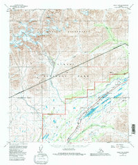
1950 Map of Healy B-5
USGS Topo · Published 1983About this map
Foggy Pass and Broad Pass anchor this high-altitude corridor where transportation infrastructure follows the natural breaks in the Alaska Range. The mid-century development of the Alaska Railroad and the George Parks Highway is clearly visible, tracing a route through the heart of what would become Denali National Park. This survey documents the intersection of modern transit and wilderness, notably around Summit Lake, where a CAA Station and aviation-related markers like VABM Summit Astro hint at the area's importance for early bush pilots and air traffic.
Find a feature on this map
32 named features on this map. Tap any name to fly to it.
Don’t see what you’re looking for? This feature index may not catch every label — zoom into the map to look around manually.
Map Details
Editions of this 1950 Healy B-5 Map
3 editions found
Other maps of this area

1949 · Healy B-4
USGS Topo · 1:63,360

1949 · Healy A-6
USGS Topo · 1:63,360

1950 · Healy C-4
USGS Topo · 1:63,360

1950 · Healy A-4
USGS Topo · 1:63,360

1950 · Healy A-5
USGS Topo · 1:63,360

1950 · Healy B-5
USGS Topo · 1:63,360

1951 · Healy
USGS Topo · 1:250,000

1951 · Healy B-5
USGS Topo · 1:63,360

1951 · Healy B-4
USGS Topo · 1:63,360

1952 · Healy C-5
USGS Topo · 1:63,360