
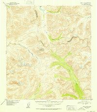
1952 Map of Healy A-4
USGS Topo · Published 1952About this map
The Jack River and its upper tributaries dominate this Alaskan interior landscape at the midpoint of the twentieth century. Steep topographic gradients define the drainage basins of the Tsusena River and the East Fork Chulitna River, illustrating the high-altitude watershed where these watercourses originate. The map documents a significant political and legal boundary between the Third Judicial Division and Fourth Judicial Division, which traverses the high ridges and crosses through Caribou Pass. This boundary, though marked as an Approximate Boundary, signifies the administrative partitioning of the territory prior to statehood. The presence of VABM 5854 Alt provides a specific geodetic reference point within the glacial-carved terrain, while smaller streams like Portage Creek and Soule Creek carve narrow paths through the surrounding peaks.
Find a feature on this map
9 named features on this map. Tap any name to fly to it.
Don’t see what you’re looking for? This feature index may not catch every label — zoom into the map to look around manually.
Map Details
Editions of this 1952 Healy A-4 Map
2 editions found
Other maps of this area

1949 · Healy B-4
USGS Topo · 1:63,360

1950 · Talkeetna Mountains
USGS Topo · 1:250,000

1950 · Talkeetna Mountains D-5
USGS Topo · 1:63,360

1950 · Healy A-3
USGS Topo · 1:63,360

1950 · Healy B-3
USGS Topo · 1:63,360

1950 · Healy A-4
USGS Topo · 1:63,360

1950 · Healy A-5
USGS Topo · 1:63,360

1950 · Healy B-5
USGS Topo · 1:63,360

1951 · Healy
USGS Topo · 1:250,000

1951 · Talkeetna Mountains D-5
USGS Topo · 1:63,360