
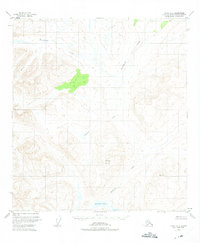
1950 Map of Healy A-3
USGS Topo · Published 1964About this map
Deadman Mountain rises as a central landmark in this 1950s interior Alaskan landscape, which was mapped via aerial photography just before the territory achieved statehood. The terrain is defined by a dense network of high-altitude waterways, including the winding course of Brushkana Creek in the north and the extensive Deadman Creek system to the south. A solitary label for Gold on a ridge in the southeast corner points to the mineral prospecting that historically drew activity to these remote highlands.
Find a feature on this map
6 named features on this map. Tap any name to fly to it.
Don’t see what you’re looking for? This feature index may not catch every label — zoom into the map to look around manually.
Map Details
Editions of this 1950 Healy A-3 Map
3 editions found
Other maps of this area

1949 · Healy B-4
USGS Topo · 1:63,360

1949 · Healy B-2
USGS Topo · 1:63,360

1950 · Talkeetna Mountains
USGS Topo · 1:250,000

1950 · Healy B-3
USGS Topo · 1:63,360

1950 · Healy A-4
USGS Topo · 1:63,360

1951 · Healy
USGS Topo · 1:250,000

1951 · Healy B-4
USGS Topo · 1:63,360

1951 · Talkeetna Mountains D-2
USGS Topo · 1:63,360

1951 · Talkeetna Mountains D-3
USGS Topo · 1:63,360

1951 · Talkeetna Mountains D-4
USGS Topo · 1:63,360