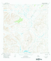
1950 Map of Healy A-3
USGS Topo · Published 1984About this map
Deadman Mountain dominates the central landscape of this 1950s Alaskan interior survey, rising as a prominent topographical anchor amidst a complex network of waterways. The terrain is defined by the winding paths of Brushkana Creek to the north and the extensive reach of Deadman Creek, which flows southward through the high country. At the southern edge of the sheet, Deadman Lake and Big Lake mark a lower elevation basin, highlighting the dramatic vertical relief of the region. The absence of roads or trails, as noted in the margin, emphasizes the undeveloped and primitive character of the Matanuska-Susitna area at mid-century. A single survey marker, VABM 4825 Gold, indicates the precision of the photogrammetric methods used to capture this high-altitude terrain before modern infrastructure reached this part of the territory.
Find a feature on this map
7 named features on this map. Tap any name to fly to it.
Don’t see what you’re looking for? This feature index may not catch every label — zoom into the map to look around manually.
Map Details
Editions of this 1950 Healy A-3 Map
3 editions found
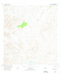
Other maps of this area

1949 · Healy B-4
USGS Topo · 1:63,360

1949 · Healy B-2
USGS Topo · 1:63,360

1950 · Talkeetna Mountains
USGS Topo · 1:250,000

1950 · Healy A-3
USGS Topo · 1:63,360

1950 · Healy B-3
USGS Topo · 1:63,360

1950 · Healy A-4
USGS Topo · 1:63,360

1951 · Healy
USGS Topo · 1:250,000

1951 · Healy B-4
USGS Topo · 1:63,360

1951 · Talkeetna Mountains D-2
USGS Topo · 1:63,360

1951 · Talkeetna Mountains D-3
USGS Topo · 1:63,360