
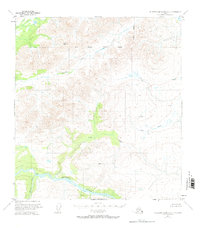
1951 Map of Talkeetna Mountains D-2
USGS Topo · Published 1964About this map
The Susitna River carves a deep valley through this interior landscape, documented by photogrammetric methods from 1949 aerial surveys. This map captures a moment when the region remained largely unsurveyed by the Bureau of Land Management, with land lines representing predetermined but unmarked locations. A lone Cabin situated near the mouth of Kosina Creek serves as the only evidence of human habitation in a territory defined by its complex drainage systems. Several prominent survey markers, including VABM 5604 Watana and VABM 4724 Brown, anchor the high ground between the river and the South Boundary Fairbanks Meridian. The intricate network of tributaries such as Watana Creek, Coal Creek, and Jay Creek illustrates the primitive state of the interior before modern development or infrastructure reached these remote elevations.
Find a feature on this map
10 named features on this map. Tap any name to fly to it.
Don’t see what you’re looking for? This feature index may not catch every label — zoom into the map to look around manually.
Map Details
Editions of this 1951 Talkeetna Mountains D-2 Map
2 editions found
Other maps of this area

1949 · Healy A-1
USGS Topo · 1:63,360

1950 · Talkeetna Mountains
USGS Topo · 1:250,000

1950 · Healy A-3
USGS Topo · 1:63,360

1951 · Healy
USGS Topo · 1:250,000

1951 · Talkeetna Mountains C-2
USGS Topo · 1:63,360

1951 · Talkeetna Mountains C-1
USGS Topo · 1:63,360

1951 · Talkeetna Mountains D-1
USGS Topo · 1:63,360

1951 · Talkeetna Mountains D-3
USGS Topo · 1:63,360

1951 · Talkeetna Mountains C-3
USGS Topo · 1:63,360

1951 · Healy A-2
USGS Topo · 1:63,360