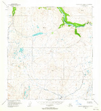
1951 Map of Talkeetna Mountains C-2
USGS Topo · Published 1963About this map
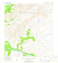
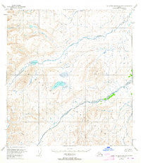
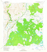
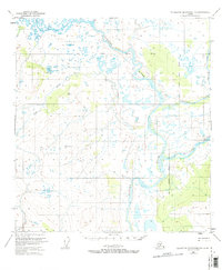
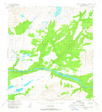
The Susitna River carves a massive course through this northern landscape, serving as the dominant hydrological feature of the region during the early 1950s. The terrain is defined by significant elevations, including high points such as VABM 5603 Goose and VABM 4192 Windus, which overlook a network of drainages like Gilbert Creek and Goose Creek.
Find a feature on this map
8 named features on this map. Tap any name to fly to it.
Don’t see what you’re looking for? This feature index may not catch every label — zoom into the map to look around manually.
Map Details
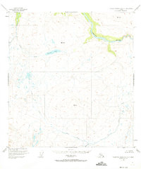
Editions of this 1951 Talkeetna Mountains C-2 Map
3 editions found

Other maps of this area

1950 · Talkeetna Mountains
USGS Topo · 1:250,000
1951 · Talkeetna Mountains B-1
USGS Topo · 1:63,360
1951 · Talkeetna Mountains B-3
USGS Topo · 1:63,360
1951 · Talkeetna Mountains D-2
USGS Topo · 1:63,360
1951 · Talkeetna Mountains B-2
USGS Topo · 1:63,360
1951 · Talkeetna Mountains C-1
USGS Topo · 1:63,360
1951 · Talkeetna Mountains D-1
USGS Topo · 1:63,360
1951 · Talkeetna Mountains D-3
USGS Topo · 1:63,360
1951 · Talkeetna Mountains C-3
USGS Topo · 1:63,360
1952 · Talkeetna Mountains D-1
USGS Topo · 1:63,360