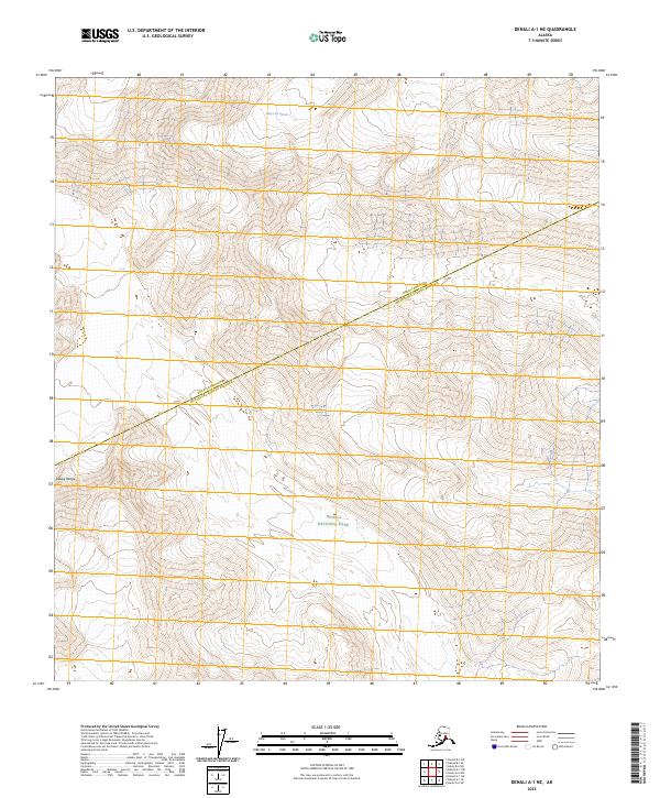
2023 Map of Denali A-1 NE
USGS Topo · Published 2023About this map
Denali National Park and the Denali Wilderness meet along the high ridges of the Alaska Range in this high-elevation terrain study. The landscape is dominated by glacial activity, most notably the West Fork Glacier which occupies the northern reaches of the quadrangle. As a modern survey, the map documents the jurisdictional divide between the Denali Borough and Matanuska-Susitna Borough, a line that cuts diagonally across the peaks and valleys. This is a region defined by its lack of human infrastructure, where the natural contours and township and range lines provide the only markers across the frozen terrain of the t19s r14w and t20s r14w surveys.
Find a feature on this map
11 named features on this map. Tap any name to fly to it.
Don’t see what you’re looking for? This feature index may not catch every label — zoom into the map to look around manually.
Map Details
Editions of this 2023 Denali A-1 NE Map
This is the sole edition of this map. No revisions or reprints were ever made.
Other maps of this area

1949 · Healy A-6
USGS Topo · 1:63,360

1951 · Healy
USGS Topo · 1:250,000

1952 · Mount McKinley
USGS Topo · 1:250,000

1952 · Mount McKinley B-1
USGS Topo · 1:63,360

1953 · Healy A-6
USGS Topo · 1:63,360

1954 · Healy B-6
USGS Topo · 1:63,360

1954 · Mount McKinley B-1
USGS Topo · 1:63,360

1954 · Mount McKinley A-1
USGS Topo · 1:63,360

1956 · Healy
USGS Topo · 1:250,000

1958 · Mount McKinley
USGS Topo · 1:250,000