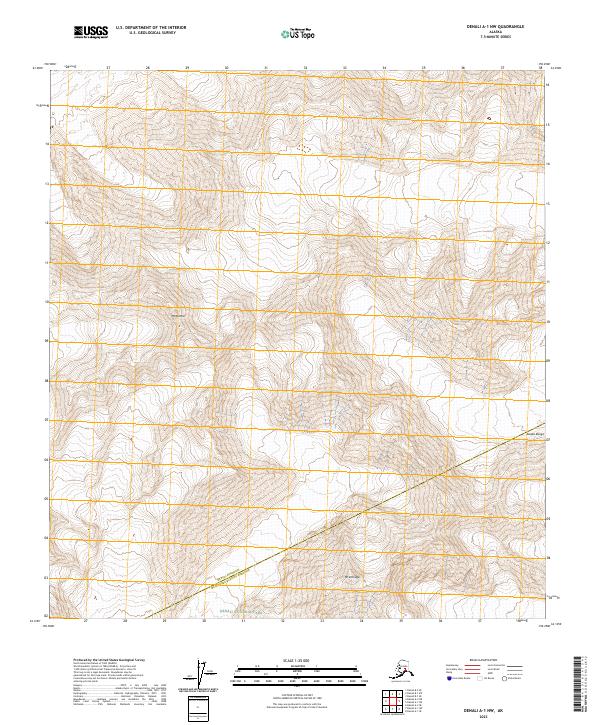
2023 Map of Denali A-1 NW
USGS Topo · Published 2023About this map
Mt Mather stands as a prominent peak within this section of the Alaska Range, where the high-altitude landscape is defined by steep glacial terrain and dramatic relief. Much of the territory is protected under the Denali Wilderness designation, which covers a significant portion of the sheet before transitioning into the broader Denali National Park to the south. The map documents the boundary where the Denali Borough meets the Matanuska-Susitna Borough, illustrating a remote wilderness area devoid of modern infrastructure or permanent settlements. This 2023 survey provides an exacting record of the contemporary glaciology and topographic shifts within one of the most protected alpine environments in the United States.
Find a feature on this map
11 named features on this map. Tap any name to fly to it.
Don’t see what you’re looking for? This feature index may not catch every label — zoom into the map to look around manually.
Map Details
Editions of this 2023 Denali A-1 NW Map
This is the sole edition of this map. No revisions or reprints were ever made.
Other maps of this area

1952 · Mount McKinley
USGS Topo · 1:250,000

1952 · Mount McKinley B-2
USGS Topo · 1:63,360

1952 · Mount McKinley B-1
USGS Topo · 1:63,360

1954 · Mount McKinley B-1
USGS Topo · 1:63,360

1954 · Mount McKinley A-2
USGS Topo · 1:63,360

1954 · Mount McKinley A-1
USGS Topo · 1:63,360

1954 · Mount McKinley B-2
USGS Topo · 1:63,360

1958 · Mount McKinley
USGS Topo · 1:250,000

1969 · Mount McKinley
USGS Topo · 1:250,000
2015 · Denali A-2 SE
USGS Topo · 1:25,000