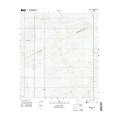
2015 Map of Denali A-2 SE
USGS Topo · Published 2015About this map
Mt Silverthrone and the surrounding high-altitude terrain dominate this part of Denali National Park, where the glacial landscape is mapped in exacting detail. The map captures the massive ice systems of the central Alaska Range, including the upper reaches of the Muldrow Glacier and Eldridge Glacier. Of particular note for alpine history are the Don Sheldon Amphitheater and Ruth Amphitheater, named for the legendary Alaskan bush pilot and the surrounding granite peaks. This 2015 data illustrates the complex topography near the border of Denali and Matanuska-Susitna Boroughs, showing the North Fork Ruth Glacier and Buckskin Glacier as they flow from landmarks like Explorers Peak and Brooks Gap.
Find a feature on this map
17 named features on this map. Tap any name to fly to it.
Don’t see what you’re looking for? This feature index may not catch every label — zoom into the map to look around manually.
Map Details
Editions of this 2015 Denali A-2 SE Map
This is the sole edition of this map. No revisions or reprints were ever made.
Other maps of this area

1950 · Talkeetna
USGS Topo · 1:250,000

1951 · Talkeetna
USGS Topo · 1:250,000

1952 · Mount McKinley
USGS Topo · 1:250,000

1954 · Mount McKinley A-2
USGS Topo · 1:63,360

1954 · Mount McKinley A-1
USGS Topo · 1:63,360

1958 · Talkeetna D-2
USGS Topo · 1:63,360
1958 · Talkeetna D-1
USGS Topo · 1:63,360

1958 · Talkeetna
USGS Topo · 1:250,000

1958 · Mount McKinley
USGS Topo · 1:250,000

1965 · Talkeetna
USGS Topo · 1:250,000