
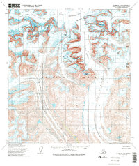
1958 Map of Talkeetna D-2
USGS Topo · Published 1963About this map
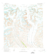
Ruth Glacier dominates this landscape, carving a massive path southward through the Alaska Range as it appeared during the late 1950s. The topographic detail, mapped by the U.S. Geological Survey in collaboration with The Museum of Science, Boston, captures the dramatic verticality of The Great Gorge and the surrounding high peaks. Notable summits such as Mount Huntington, Mount Dickey, and the distinctive granite spire of The Mooses Tooth frame the Ruth Amphitheater. The drainage patterns are clearly defined, showing the confluence of the West Fork Ruth Glacier and the adjacent Tokositna Glacier. To the east, Buckskin Glacier flows parallel, separated by high ridges including The Rooster Comb. This survey provides a precise record of glacial extent and alpine topography before the era of modern satellite monitoring.
Find a feature on this map
17 named features on this map. Tap any name to fly to it.
Don’t see what you’re looking for? This feature index may not catch every label — zoom into the map to look around manually.
Map Details
Editions of this 1958 Talkeetna D-2 Map
3 editions found
Other maps of this area

1950 · Talkeetna
USGS Topo · 1:250,000

1951 · Talkeetna
USGS Topo · 1:250,000

1951 · Talkeetna C-1
USGS Topo · 1:63,360

1952 · Mount McKinley
USGS Topo · 1:250,000

1954 · Mount McKinley A-2
USGS Topo · 1:63,360

1954 · Mount McKinley A-3
USGS Topo · 1:63,360

1954 · Mount McKinley A-1
USGS Topo · 1:63,360

1958 · Talkeetna C-1
USGS Topo · 1:63,360

1958 · Talkeetna C-2
USGS Topo · 1:63,360

1958 · Talkeetna C-3
USGS Topo · 1:63,360