
1958 Map of Talkeetna C-3
USGS Topo · Published 1963About this map
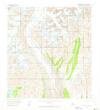
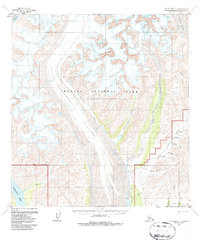
The massive Kahiltna Glacier dominates this mid-century Alaskan landscape, its icy expanse marked by dangerous crevasses and flanked by the Lacuna Glacier. This environment shows early signs of resource exploration and remote habitation, particularly in the south and east where a Tractor Trail provides a lifeline for industrial activity. A solitary Mine and a nearby Landing Strip underscore the area's reliance on aviation and rugged overland transport during the 1950s. Settlement is sparse, limited to scattered Cabins and a Cabin near the drainage of Granite Creek. In the lower elevations, the Dutch Hills provide a geographical anchor for numerous waterways, including Dutch Creek and Dollar Creek, which flow toward the large Chelatna Lake in the southwest corner. The map reflects a period when the Bureau of Land Management was predetermining land lines for unsurveyed wilderness.
Find a feature on this map
25 named features on this map. Tap any name to fly to it.
Don’t see what you’re looking for? This feature index may not catch every label — zoom into the map to look around manually.
Map Details
Editions of this 1958 Talkeetna C-3 Map
3 editions found
Other maps of this area

1950 · Talkeetna
USGS Topo · 1:250,000

1951 · Talkeetna
USGS Topo · 1:250,000

1954 · Talkeetna B-4
USGS Topo · 1:63,360

1954 · Talkeetna B-3
USGS Topo · 1:63,360

1954 · Talkeetna B-2
USGS Topo · 1:63,360

1958 · Talkeetna C-4
USGS Topo · 1:63,360

1958 · Talkeetna C-2
USGS Topo · 1:63,360

1958 · Talkeetna D-4
USGS Topo · 1:63,360

1958 · Talkeetna D-2
USGS Topo · 1:63,360

1958 · Talkeetna D-3
USGS Topo · 1:63,360