
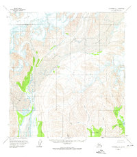
1958 Map of Talkeetna C-4
USGS Topo · Published 1963About this map
Dall Glacier, Yentna Glacier, and the massive Lacuna Glacier dominate this interior Alaskan landscape, their ice fields carving deep valleys into the surrounding peaks. Mapped via aerial photography in the early 1950s, the terrain shows a raw, glaciated environment where the East Fork Yentna River emerges from the ice to wind through gravel bars and braided channels. To the southeast, the topography descends toward Chelatna Lake, fed by a network of drainage systems including Snowslide Creek and Easter Creek. The drainage patterns here are complex, with features like Sunflower Basin and Stern Gulch illustrating the sheer scale of the runoff from the high ice. While no roads or trails are noted on this survey, the naming of various tributaries like Idaho Creek, California Creek, and Colorado Creek suggests a history of prospecting or regional travel during earlier eras of exploration.
Find a feature on this map
17 named features on this map. Tap any name to fly to it.
Don’t see what you’re looking for? This feature index may not catch every label — zoom into the map to look around manually.
Map Details
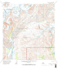
Editions of this 1958 Talkeetna C-4 Map
3 editions found
Other maps of this area

1950 · Talkeetna
USGS Topo · 1:250,000

1951 · Talkeetna
USGS Topo · 1:250,000

1954 · Talkeetna B-4
USGS Topo · 1:63,360

1954 · Talkeetna B-3
USGS Topo · 1:63,360

1958 · Talkeetna B-5
USGS Topo · 1:63,360

1958 · Talkeetna D-5
USGS Topo · 1:63,360

1958 · Talkeetna D-4
USGS Topo · 1:63,360

1958 · Talkeetna C-3
USGS Topo · 1:63,360

1958 · Talkeetna D-3
USGS Topo · 1:63,360

1958 · Talkeetna C-5
USGS Topo · 1:63,360