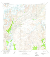
1958 Map of Talkeetna C-4
USGS Topo · Published 1974About this map
Dall Glacier and Yentna Glacier dominate the northern terrain of this high-latitude survey, showing the massive ice flows as they appeared in the mid-20th century. The landscape is defined by the heavy glacial drainage feeding into the East Fork Yentna River, which cuts a wide path through the western portion of the quadrangle. In the southeast, Chelatna Lake marks a significant transition point where the high peaks descend into water-carved basins.
Find a feature on this map
15 named features on this map. Tap any name to fly to it.
Don’t see what you’re looking for? This feature index may not catch every label — zoom into the map to look around manually.
Map Details
Editions of this 1958 Talkeetna C-4 Map
3 editions found
Other maps of this area

1950 · Talkeetna
USGS Topo · 1:250,000

1951 · Talkeetna
USGS Topo · 1:250,000

1954 · Talkeetna B-4
USGS Topo · 1:63,360

1954 · Talkeetna B-3
USGS Topo · 1:63,360

1958 · Talkeetna B-5
USGS Topo · 1:63,360

1958 · Talkeetna D-5
USGS Topo · 1:63,360

1958 · Talkeetna C-4
USGS Topo · 1:63,360

1958 · Talkeetna D-4
USGS Topo · 1:63,360

1958 · Talkeetna C-3
USGS Topo · 1:63,360

1958 · Talkeetna D-3
USGS Topo · 1:63,360