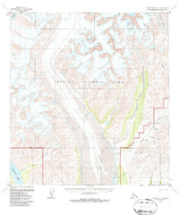
1958 Map of Talkeetna C-3
USGS Topo · Published 1987About this map
Kahiltna Glacier dominates the central corridor of this Alaskan landscape, illustrating the scale of the glacial systems flowing south from the heart of Denali National Park. The survey captures a high-altitude wilderness defined by the Park Boundary and the massive ice fields of Kanikula Glacier and Lacuna Glacier. South of the protected park lands, the Dutch Hills reveal a different character of land use, where small-scale human activity is visible through a scattered Mine, various Cabins, and a Tractor Trail following the creek beds.
Find a feature on this map
26 named features on this map. Tap any name to fly to it.
Don’t see what you’re looking for? This feature index may not catch every label — zoom into the map to look around manually.
Map Details
Editions of this 1958 Talkeetna C-3 Map
3 editions found
Other maps of this area

1950 · Talkeetna
USGS Topo · 1:250,000

1951 · Talkeetna
USGS Topo · 1:250,000

1954 · Talkeetna B-4
USGS Topo · 1:63,360

1954 · Talkeetna B-3
USGS Topo · 1:63,360

1954 · Talkeetna B-2
USGS Topo · 1:63,360

1958 · Talkeetna C-4
USGS Topo · 1:63,360

1958 · Talkeetna C-2
USGS Topo · 1:63,360

1958 · Talkeetna D-4
USGS Topo · 1:63,360

1958 · Talkeetna D-2
USGS Topo · 1:63,360

1958 · Talkeetna C-3
USGS Topo · 1:63,360