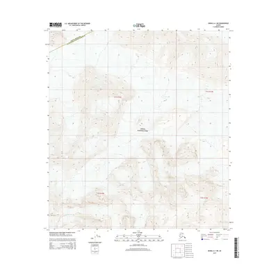
2015 Map of Denali A-1 SW
USGS Topo · Published 2015About this map
Denali National Park dominates this high-altitude landscape, where the administrative line between the Denali Borough and Matanuska-Susitna Borough cuts across the northern slopes. The map reveals a world of ice and elevation, most notably the lower reaches of Buckskin Glacier in the southwest corner. The terrain is defined by extreme verticality, with contour lines indicating steep ridges and glacial valleys that feed into the larger Alaskan wilderness. This 2015 study provides a precise look at the glaciated topography and political boundaries within one of the state's most iconic protected areas before further environmental shifts altered the glacial footprints.
Find a feature on this map
7 named features on this map. Tap any name to fly to it.
Don’t see what you’re looking for? This feature index may not catch every label — zoom into the map to look around manually.
Map Details
Editions of this 2015 Denali A-1 SW Map
This is the sole edition of this map. No revisions or reprints were ever made.
Other maps of this area

1950 · Talkeetna
USGS Topo · 1:250,000

1951 · Talkeetna
USGS Topo · 1:250,000

1952 · Mount McKinley
USGS Topo · 1:250,000

1954 · Mount McKinley A-2
USGS Topo · 1:63,360

1954 · Mount McKinley A-1
USGS Topo · 1:63,360

1958 · Talkeetna D-2
USGS Topo · 1:63,360
1958 · Talkeetna D-1
USGS Topo · 1:63,360

1958 · Talkeetna
USGS Topo · 1:250,000

1958 · Mount McKinley
USGS Topo · 1:250,000

1965 · Talkeetna
USGS Topo · 1:250,000