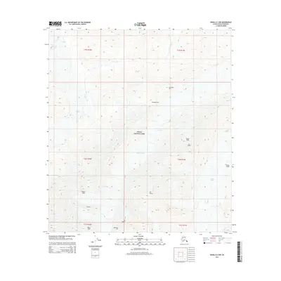
2015 Map of Denali A-2 NW
USGS Topo · Published 2015About this map
Denali National Park encompasses this landscape of the Alaska Range, dominated by massive ice systems and high-altitude ridges. The ice movement is visible through the Muldrow Glacier and Peters Glacier, which are fed by the Lower Icefall and Great Icefall. This map details the physical geography that has challenged climbers for decades, showing the specific routes and features like Karstens Col and Pioneer Ridge. Prominent peaks including Mt Koven, Mt Carpe, and Mt Tatum define the eastern and southern portions of the quadrangle. The map captures the complex interaction of glacial flow and mountain topography, where features such as Carpe Ridge and Taylor Spur divide the watershed of Carlson Creek from the expansive ice fields.
Find a feature on this map
24 named features on this map. Tap any name to fly to it.
Don’t see what you’re looking for? This feature index may not catch every label — zoom into the map to look around manually.
Map Details
Editions of this 2015 Denali A-2 NW Map
This is the sole edition of this map. No revisions or reprints were ever made.
Other maps of this area

1952 · Mount McKinley
USGS Topo · 1:250,000

1952 · Mount McKinley B-2
USGS Topo · 1:63,360

1953 · Mount McKinley B-3
USGS Topo · 1:63,360

1954 · Mount McKinley B-3
USGS Topo · 1:63,360

1954 · Mount McKinley A-2
USGS Topo · 1:63,360

1954 · Mount McKinley A-3
USGS Topo · 1:63,360

1954 · Mount McKinley B-2
USGS Topo · 1:63,360

1958 · Mount McKinley
USGS Topo · 1:250,000

1969 · Mount McKinley
USGS Topo · 1:250,000
2015 · Denali A-3 NE
USGS Topo · 1:25,000