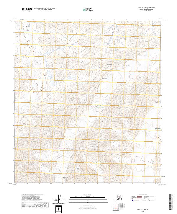
2023 Map of Denali A-2 NW
USGS Topo · Published 2023About this map
Pioneer Ridge and the high elevations of the Alaska Range dominate this northern interior landscape, where glacial features and steep rock formations define the topography. The area is preserved within Denali National Park and the adjacent Denali Wilderness, protecting a network of named peaks and ridges that serve as significant landmarks for mountaineers and explorers. Notable summits include Mt Koven, Mt Tatum, and Mt Carpe, the latter of which is flanked by the sharp descent of Carpe Ridge.
Find a feature on this map
20 named features on this map. Tap any name to fly to it.
Don’t see what you’re looking for? This feature index may not catch every label — zoom into the map to look around manually.
Map Details
Editions of this 2023 Denali A-2 NW Map
This is the sole edition of this map. No revisions or reprints were ever made.
Other maps of this area

1952 · Mount McKinley
USGS Topo · 1:250,000

1952 · Mount McKinley B-2
USGS Topo · 1:63,360

1953 · Mount McKinley B-3
USGS Topo · 1:63,360

1954 · Mount McKinley B-3
USGS Topo · 1:63,360

1954 · Mount McKinley A-2
USGS Topo · 1:63,360

1954 · Mount McKinley A-3
USGS Topo · 1:63,360

1954 · Mount McKinley B-2
USGS Topo · 1:63,360

1958 · Mount McKinley
USGS Topo · 1:250,000

1969 · Mount McKinley
USGS Topo · 1:250,000
2015 · Denali A-3 NE
USGS Topo · 1:25,000