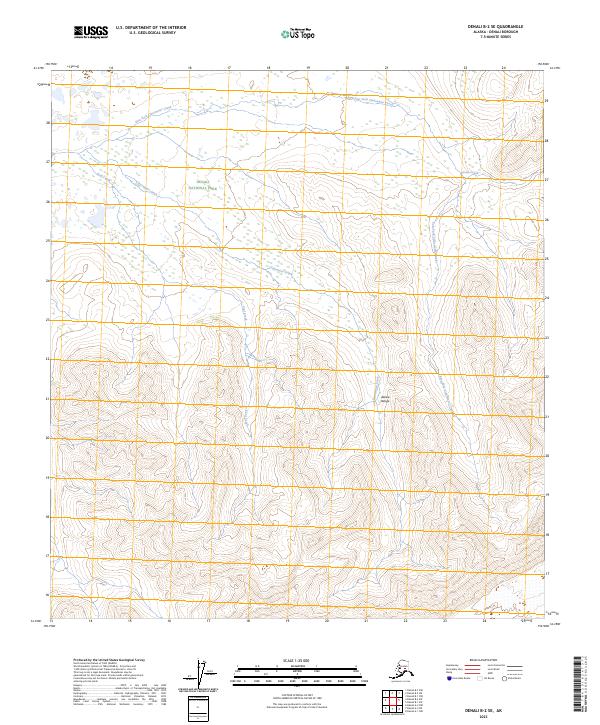
2023 Map of Denali B-2 SE
USGS Topo · Published 2023About this map
Denali National Park and the Denali Wilderness define this high-latitude terrain, where the peaks of the Alaska Range dominate the southern half of the sheet. The landscape is a complex network of glacial and mountain drainage, characterized by the winding paths of Clearwater Creek and the East Fork Clearwater Creek. These waterways, alongside Coal Creek and Pirate Creek, demonstrate the intricate erosion patterns typical of the Alaskan interior. The absence of roads or permanent structures emphasizes the preserved character of this protected wilderness, as surveyed by the U.S. Geological Survey to reflect the current topography of the region.
Find a feature on this map
13 named features on this map. Tap any name to fly to it.
Don’t see what you’re looking for? This feature index may not catch every label — zoom into the map to look around manually.
Map Details
Editions of this 2023 Denali B-2 SE Map
This is the sole edition of this map. No revisions or reprints were ever made.
Other maps of this area

1952 · Mount McKinley
USGS Topo · 1:250,000

1952 · Mount McKinley B-2
USGS Topo · 1:63,360

1952 · Mount McKinley B-1
USGS Topo · 1:63,360

1954 · Mount McKinley B-1
USGS Topo · 1:63,360

1954 · Mount McKinley A-2
USGS Topo · 1:63,360

1954 · Mount McKinley A-1
USGS Topo · 1:63,360

1954 · Mount McKinley B-2
USGS Topo · 1:63,360

1958 · Mount McKinley
USGS Topo · 1:250,000

1969 · Mount McKinley
USGS Topo · 1:250,000
2015 · Denali B-2 SW
USGS Topo · 1:25,000