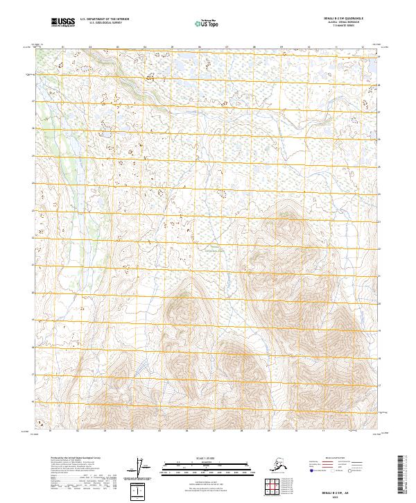
2023 Map of Denali B-2 SW
USGS Topo · Published 2023About this map
Denali National Park and the Denali Wilderness define this protected interior landscape, where high-elevation terrain meets a complex network of glacial and snowmelt drainage. The southern portion of the quadrangle is dominated by steep mountain slopes that feed several major watercourses, including the north-flowing Muddy River and Carlson Creek. This 2023 edition reflects the modern boundaries of the wilderness area within the broader park system, capturing the hydrologic pattern of Clearwater Creek as it traverses the lower-lying northern flats. The map serves as a vital record for understanding the topographical relationship between the high peaks of the Alaska Range and the winding river valleys like Cache Creek that carve through the Denali backcountry.
Find a feature on this map
10 named features on this map. Tap any name to fly to it.
Don’t see what you’re looking for? This feature index may not catch every label — zoom into the map to look around manually.
Map Details
Editions of this 2023 Denali B-2 SW Map
This is the sole edition of this map. No revisions or reprints were ever made.
Other maps of this area

1952 · Mount McKinley
USGS Topo · 1:250,000

1952 · Mount McKinley B-2
USGS Topo · 1:63,360

1953 · Mount McKinley B-3
USGS Topo · 1:63,360

1954 · Mount McKinley B-3
USGS Topo · 1:63,360

1954 · Mount McKinley A-2
USGS Topo · 1:63,360

1954 · Mount McKinley A-3
USGS Topo · 1:63,360

1954 · Mount McKinley B-2
USGS Topo · 1:63,360

1958 · Mount McKinley
USGS Topo · 1:250,000

1969 · Mount McKinley
USGS Topo · 1:250,000
2015 · Denali A-3 NE
USGS Topo · 1:25,000