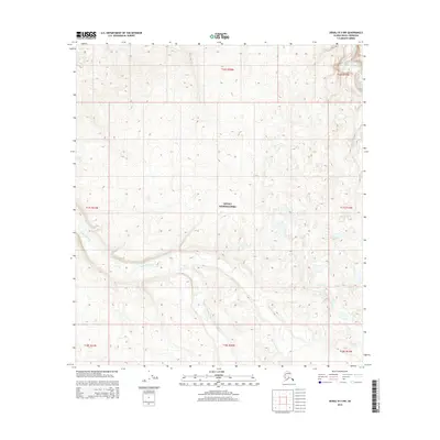
2015 Map of Denali B-3 NW
USGS Topo · Published 2015About this map
Denali National Park encompasses the vast majority of this landscape, documented in 2015 by the U.S. Geological Survey. The terrain is defined by the braided path of the McKinley River in the northeast and the winding course of Slippery Creek as it moves through the southern and central sections of the quadrangle. Smaller drainages like McLeod Cr feed into the larger water systems, illustrating the complex hydrology of this interior Alaskan wilderness. This survey emphasizes the natural topography and water flow within protected federal lands, where human infrastructure is largely absent. The map's detail focuses on the subtle elevation changes and drainage patterns that characterize the area's subarctic environment, providing a technical baseline for the park's geographic layout at the start of the twenty-first century.
Find a feature on this map
11 named features on this map. Tap any name to fly to it.
Don’t see what you’re looking for? This feature index may not catch every label — zoom into the map to look around manually.
Map Details
Editions of this 2015 Denali B-3 NW Map
This is the sole edition of this map. No revisions or reprints were ever made.
Other maps of this area

1952 · Mount McKinley
USGS Topo · 1:250,000

1952 · Mount McKinley C-3
USGS Topo · 1:63,360

1953 · Mount McKinley B-4
USGS Topo · 1:63,360

1953 · Mount McKinley B-3
USGS Topo · 1:63,360

1953 · Mount McKinley C-4
USGS Topo · 1:63,360

1954 · Mount McKinley C-4
USGS Topo · 1:63,360

1954 · Mount McKinley B-3
USGS Topo · 1:63,360

1958 · Mount McKinley
USGS Topo · 1:250,000

1969 · Mount McKinley
USGS Topo · 1:250,000
2015 · Denali C-3 SE
USGS Topo · 1:25,000