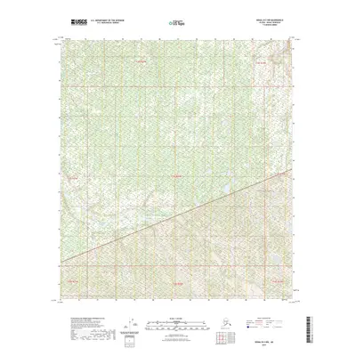
2023 Map of Denali B-3 NW
USGS Topo · Published 2023About this map
Denali National Park and the contiguous Denali Wilderness form the backbone of this interior Alaskan landscape. This survey reveals a complex hydrological network defined by the braided path of the McKinley River as it cuts through the northeastern corner of the quadrangle. The terrain is further etched by the winding course of Slippery Creek, which drains through the central and southern sections of the map. The vast majority of the land is preserved within these protected federal boundaries, showing a landscape almost entirely devoid of human infrastructure or permanent settlements, characterized instead by high-latitude wetlands and seasonal drainage patterns typical of the northern foothills.
Find a feature on this map
12 named features on this map. Tap any name to fly to it.
Don’t see what you’re looking for? This feature index may not catch every label — zoom into the map to look around manually.
Map Details
Editions of this 2023 Denali B-3 NW Map
This is the sole edition of this map. No revisions or reprints were ever made.
Other maps of this area

1952 · Mount McKinley
USGS Topo · 1:250,000

1952 · Mount McKinley C-3
USGS Topo · 1:63,360

1953 · Mount McKinley B-4
USGS Topo · 1:63,360

1953 · Mount McKinley B-3
USGS Topo · 1:63,360

1953 · Mount McKinley C-4
USGS Topo · 1:63,360

1954 · Mount McKinley C-4
USGS Topo · 1:63,360

1954 · Mount McKinley B-3
USGS Topo · 1:63,360

1958 · Mount McKinley
USGS Topo · 1:250,000

1969 · Mount McKinley
USGS Topo · 1:250,000
2015 · Denali C-3 SE
USGS Topo · 1:25,000