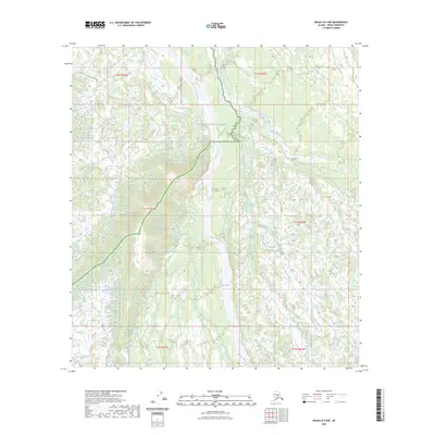
2023 Map of Denali B-4 NW
USGS Topo · Published 2023About this map
Foraker River dominates the central drainage of this interior Alaska wilderness, carving a wide path through the protected lands of Denali National Preserve and Denali National Park. The landscape is defined by its complex hydrology, where several smaller tributaries including Birch Creek, White Creek, and Hill Creek converge towards the river valley. The topography reveals the transition from higher elevations in the west, marked by significant contour lines, down toward the expansive river flats. This 2023 survey serves as a contemporary record of the shifting braided channels of the Foraker River as it traverses the boundary between the national preserve and the national park, illustrating the undisturbed glacial drainage patterns characteristic of the Denali region.
Find a feature on this map
12 named features on this map. Tap any name to fly to it.
Don’t see what you’re looking for? This feature index may not catch every label — zoom into the map to look around manually.
Map Details
Editions of this 2023 Denali B-4 NW Map
This is the sole edition of this map. No revisions or reprints were ever made.
Other maps of this area

1952 · Mount McKinley
USGS Topo · 1:250,000

1953 · Mount McKinley C-5
USGS Topo · 1:63,360

1953 · Mount McKinley B-4
USGS Topo · 1:63,360

1953 · Mount McKinley B-5
USGS Topo · 1:63,360

1953 · Mount McKinley C-4
USGS Topo · 1:63,360

1954 · Mount McKinley C-4
USGS Topo · 1:63,360

1954 · Mount McKinley B-5
USGS Topo · 1:63,360

1954 · Mount McKinley C-5
USGS Topo · 1:63,360

1958 · Mount McKinley
USGS Topo · 1:250,000

1969 · Mount McKinley
USGS Topo · 1:250,000