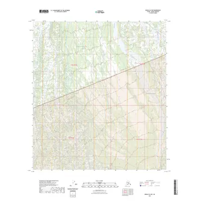
2023 Map of Denali B-4 SW
USGS Topo · Published 2023About this map
Denali National Park and the preserved expanse of the Denali Wilderness dominate this interior Alaskan landscape, where the braided channels of the Foraker River flow through the eastern portion of the survey. The terrain is characterized by high-altitude hydrography, including the headwaters of White Creek and the drainage of Bluff Creek. This 2023 documentation reveals a strictly natural environment, devoid of modern settlements or road infrastructure, defined instead by the township and range lines of the public land survey system. The map serves as a precise record of the current state of these federally protected lands, illustrating the complex drainage patterns and topographic contours that dictate the movement of water and ice across this subarctic wilderness.
Find a feature on this map
9 named features on this map. Tap any name to fly to it.
Don’t see what you’re looking for? This feature index may not catch every label — zoom into the map to look around manually.
Map Details
Editions of this 2023 Denali B-4 SW Map
This is the sole edition of this map. No revisions or reprints were ever made.
Other maps of this area

1952 · Mount McKinley
USGS Topo · 1:250,000

1952 · Mount McKinley A-5
USGS Topo · 1:63,360

1953 · Mount McKinley B-4
USGS Topo · 1:63,360

1953 · Mount McKinley B-5
USGS Topo · 1:63,360

1953 · Mount McKinley A-4
USGS Topo · 1:63,360

1954 · Mount McKinley A-4
USGS Topo · 1:63,360

1954 · Mount McKinley B-5
USGS Topo · 1:63,360

1954 · Mount McKinley A-5
USGS Topo · 1:63,360

1958 · Mount McKinley
USGS Topo · 1:250,000

1969 · Mount McKinley
USGS Topo · 1:250,000