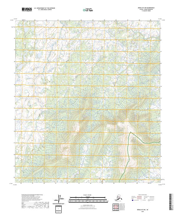
2023 Map of Denali B-5 NE
USGS Topo · Published 2023About this map
Denali National Preserve and Denali National Park define the administrative landscape of this wilderness region, where the Public Land Survey System (PLSS) provides the primary framework for orientation. This 2023 survey documents the topography of the Alaska interior, with elevations defined by complex contour lines and hydrological networks. The map covers portions of several townships including T17s R24w, T16s R24w, and T18s R24w, illustrating the transition from protected preserve lands to the national park boundaries. Without roads or named settlements, the map focuses on the raw terrain data, reflecting the preservation of this ecosystem as it exists in the early twenty-first century. It is a vital document for those studying the intersection of federal land management and the glacial-carved geology of the Denali region.
Find a feature on this map
10 named features on this map. Tap any name to fly to it.
Don’t see what you’re looking for? This feature index may not catch every label — zoom into the map to look around manually.
Map Details
Editions of this 2023 Denali B-5 NE Map
This is the sole edition of this map. No revisions or reprints were ever made.
Other maps of this area

1952 · Mount McKinley
USGS Topo · 1:250,000

1953 · Mount McKinley C-5
USGS Topo · 1:63,360

1953 · Mount McKinley B-4
USGS Topo · 1:63,360

1953 · Mount McKinley B-5
USGS Topo · 1:63,360

1953 · Mount McKinley C-4
USGS Topo · 1:63,360

1954 · Mount McKinley C-4
USGS Topo · 1:63,360

1954 · Mount McKinley B-5
USGS Topo · 1:63,360

1954 · Mount McKinley C-5
USGS Topo · 1:63,360

1958 · Mount McKinley
USGS Topo · 1:250,000

1969 · Mount McKinley
USGS Topo · 1:250,000