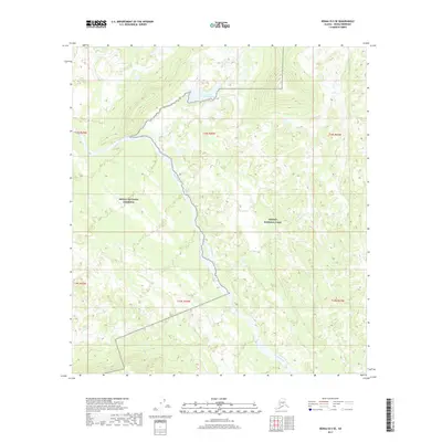
2017 Map of Denali B-5 SE
USGS Topo · Published 2017About this map
The Herron River flows through this interior Alaskan wilderness, carving a path through the intersection of the Denali National Park and the Denali National Preserve. This 2017 survey details a landscape where water and terrain dictate the geography, most notably at Castle Rocks Lake in the northern portion of the quadrangle. In the southwest, the headwaters of Wolf Cr emerge from the high ground. The map captures a moment in the modern management of this protected area, illustrating the administrative boundaries and natural watercourses that define the region. For those studying the hydrology or boundary history of the Denali region, the sheet provides exact placements of these interior landmarks as they existed in the early twenty-first century.
Find a feature on this map
11 named features on this map. Tap any name to fly to it.
Don’t see what you’re looking for? This feature index may not catch every label — zoom into the map to look around manually.
Map Details
Editions of this 2017 Denali B-5 SE Map
This is the sole edition of this map. No revisions or reprints were ever made.
Other maps of this area

1952 · Mount McKinley
USGS Topo · 1:250,000

1952 · Mount McKinley A-5
USGS Topo · 1:63,360

1953 · Mount McKinley B-4
USGS Topo · 1:63,360

1953 · Mount McKinley B-5
USGS Topo · 1:63,360

1953 · Mount McKinley A-4
USGS Topo · 1:63,360

1954 · Mount McKinley A-4
USGS Topo · 1:63,360

1954 · Mount McKinley B-5
USGS Topo · 1:63,360

1954 · Mount McKinley A-5
USGS Topo · 1:63,360

1958 · Mount McKinley
USGS Topo · 1:250,000

1969 · Mount McKinley
USGS Topo · 1:250,000