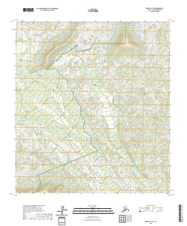
2023 Map of Denali B-5 SE
USGS Topo · Published 2023About this map
Denali National Park and the Denali Wilderness converge in this subarctic landscape, where high-latitude drainage patterns are defined by the Herron River as it winds south through the center of the quadrangle. The northern reach is anchored by Castle Rocks Lake, a prominent water body situated near the boundary between the park and the Denali National Preserve. This modern survey illustrates the complex intersection of federal land designations in interior Alaska, mapping the transition from protected wilderness to preserve lands. The topography is marked by the course of Wolf Creek in the southwest, reflecting a remote riverine ecosystem largely untouched by modern infrastructure. The detailed contour work provides insight into the glacial and fluvial geomorphology that dictates the movement of water across these protected interior corridors.
Find a feature on this map
12 named features on this map. Tap any name to fly to it.
Don’t see what you’re looking for? This feature index may not catch every label — zoom into the map to look around manually.
Map Details
Editions of this 2023 Denali B-5 SE Map
This is the sole edition of this map. No revisions or reprints were ever made.
Other maps of this area

1952 · Mount McKinley
USGS Topo · 1:250,000

1952 · Mount McKinley A-5
USGS Topo · 1:63,360

1953 · Mount McKinley B-4
USGS Topo · 1:63,360

1953 · Mount McKinley B-5
USGS Topo · 1:63,360

1953 · Mount McKinley A-4
USGS Topo · 1:63,360

1954 · Mount McKinley A-4
USGS Topo · 1:63,360

1954 · Mount McKinley B-5
USGS Topo · 1:63,360

1954 · Mount McKinley A-5
USGS Topo · 1:63,360

1958 · Mount McKinley
USGS Topo · 1:250,000

1969 · Mount McKinley
USGS Topo · 1:250,000