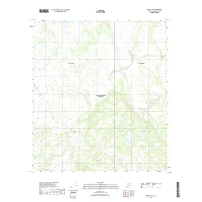
2017 Map of Denali C-5 SE
USGS Topo · Published 2017About this map
Denali National Preserve encompasses most of this 2017 survey area, revealing a wilderness landscape defined by shifting glacial rivers and interior wetlands. The Foraker River and Herron River dominate the hydrology, carving braided channels across the northern half of the quadrangle. These rivers are joined by the meandering Hot Slough, creating a complex network of seasonal watercourses and overflow channels characteristic of the Alaska Range foothills. To the south, the terrain rises into more defined topographic relief, where Live Trap Lake sits as a notable landmark amidst the undulating forest and tundra. The map provides precise detail on the Public Land Survey System divisions, marking the boundaries for t15s r24w, t15s r23w, t16s r24w, and t16s r23w. This modern topographical study serves as a clear record of the area’s natural drainage patterns and land status within the national preserve.
Find a feature on this map
9 named features on this map. Tap any name to fly to it.
Don’t see what you’re looking for? This feature index may not catch every label — zoom into the map to look around manually.
Map Details
Editions of this 2017 Denali C-5 SE Map
This is the sole edition of this map. No revisions or reprints were ever made.
Other maps of this area

1952 · Mount McKinley
USGS Topo · 1:250,000

1953 · Mount McKinley C-5
USGS Topo · 1:63,360

1953 · Mount McKinley B-4
USGS Topo · 1:63,360

1953 · Mount McKinley B-5
USGS Topo · 1:63,360

1953 · Mount McKinley C-4
USGS Topo · 1:63,360

1954 · Mount McKinley C-4
USGS Topo · 1:63,360

1954 · Mount McKinley B-5
USGS Topo · 1:63,360

1954 · Mount McKinley C-5
USGS Topo · 1:63,360

1958 · Mount McKinley
USGS Topo · 1:250,000

1969 · Mount McKinley
USGS Topo · 1:250,000